Respected Leader for Costa Rica Adventure & Nature Vacations Since 1991
All other countries: +506 4001-3860
Costa Rica Roads and Driving
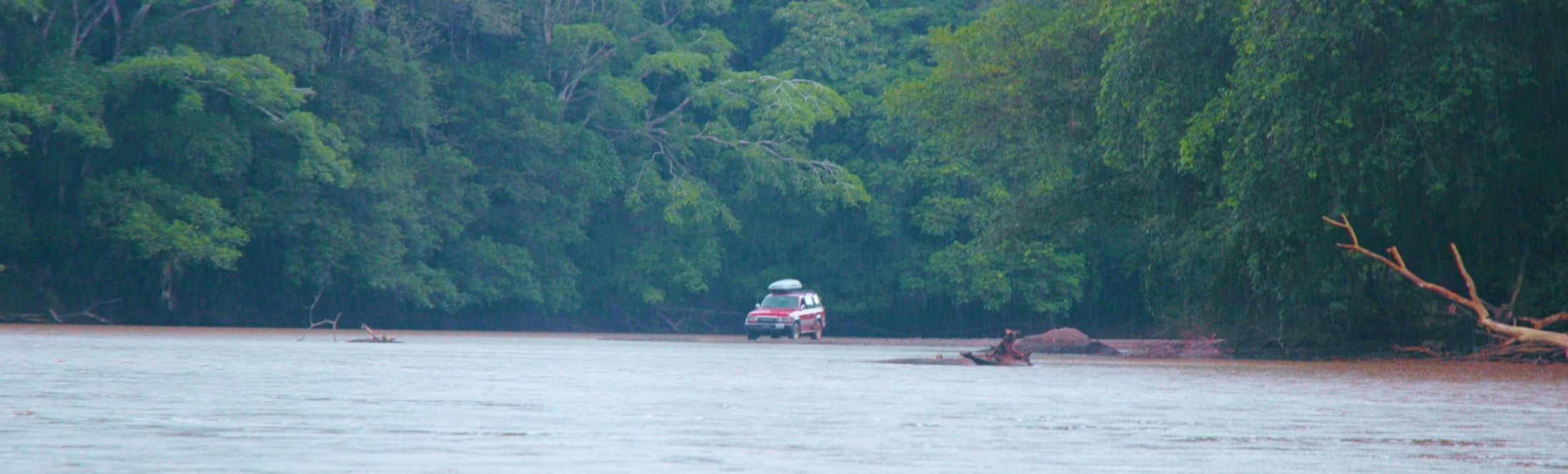
Believe the road map or believe your eyes
Surprise! There's no bridge on this road.
Roads: Much improved in the past 20 years
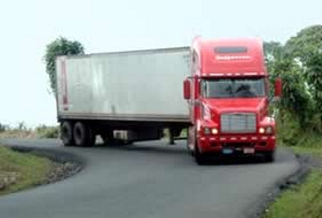
This is a major Costa Rican thoroughfare. There are no line markers or reflectors to mark the edge of the road, and the road is so narrow and curvy that the many semis that drive on this stretch must use the entire width of the surface.
Costa Rica's Roads Can't Handle the Traffic
As Costa Rica's middle class has blossomed, so too has the car population. Meanwhile the roads have not grown to match the 4% annual growth in personal vehicles of recent years. This means driving times have increased disproportionately -- whereas in 2005 you could drive from San José center of the city to the Puntarenas Ferry in 2 hours, that same drive now takes 4 hours if you try it between 2 PM and 8 PM. Driving from the airport to Playa Jaco, normally 90 minutes, may take 4 to 5 hours during peak times.
Talk About Dangers on Highways
By far the most dangerous activity of Serendipity is driving on the main roads of the country, especially after dark, with no white outer edge lines, no center yellow lines, no reflecting cat eyes on curves, no guard rails, a LARGE selection of speed bumps or potholes, lots of trucks going 10 miles an hour with no taillights, and pedestrians who believe that, if they can see your headlights, certainly you can see them in the middle of the road, and, the crowning glory, dense, tropical fog. Did we also mention, no direction signs or route numbers? Serendipity guides do almost anything to avoid driving at night, but sometimes it is unavoidable.
To point out something that straight numbers, especially really big numbers, only hide: In 2017 Citibank, the credit card company, paid computer programmers more to find viruses infections than the whole country of Costa Rica used to operate its national government, including its heath care, education, retirement, and road building and maintenance. Does this give you an idea of what it means to be in the Third World?
Costa Rican road maps were written for the gullible.
Many of the "roads" shown are really political boundaries. Some roads shown as paved were once paved with 4 inches of hand-pressed asphalt, then destroyed by heavy trucks, mud slides, volcanoes, earthquakes, hard rain, bombas de agua and other natural disasters. The distance from Arenal Volcano to Monteverde, for example, is shown as about 35 miles. The route on the map is clear, but once on the dirt roads up to Monteverde you'll find it's like driving through an English maze -- no markings, nothing at forks in the road to point you to the cloud forest, no clear major road, and only a GPS could save you. The drive, for the in-the-know, takes about 3 hours and is ill-advised without 4 wheel drive. So think of the getting there as half (or more) of the adventure, and remember -- relax, you're in paradise, and the adventure of getting there is exactly that... adventure, if you stay calm and let your Serendipity guide handle the traffic